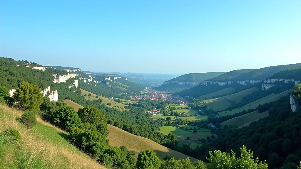
Divoká Šárka Valley: Beginner Routes Through Prague's Green Heart
Easy loops with minimal elevation gain, stunning views of the gorge, and plenty of rest areas near the city.
Limestone hills with marked trails offering gradual climbs, archaeological sites, and sweeping views across the Moravian landscape.
The Pálava Hills rise dramatically from the southern edge of the Moravia region, just 50 kilometers south of Brno. What makes this place special for older adults isn't just the gentle terrain — it's the combination of accessible paths, genuine historical significance, and the kind of landscape that rewards every step. You'll walk through limestone formations that've shaped the region for millennia, past vineyards, and alongside archaeological sites that tell the story of early Central European settlements.
Unlike some hiking destinations that feel disconnected from real life, the Pálava area integrates seamlessly with small villages, local wine production, and centuries of human history. It's not wilderness for wilderness's sake — it's landscape you can actually engage with. The marked trails start easy and gradually build in difficulty, which means you're not locked into one experience. A 45-year-old taking their first real hike can do the same loop as someone who's been walking regularly for decades.
Pálava has three main marked routes, each designed for different fitness levels. The color-coded system is straightforward — you won't get confused about which path you're on. What's important here is that the trails aren't just "graded" on paper. They're actually maintained with the realities of older walkers in mind: good footing, adequate signage, and rest areas positioned logically.
The green loop starts from Mělnická Vrutice village and stays mostly on flat ground with gradual, manageable slopes. It's genuinely easy — we're not talking about the "easy" that really means moderate. You'll pass through forest sections, cross a small stream twice, and get views of the limestone cliffs without ever feeling like you're climbing. This is the route if you want to build confidence or just spend time outdoors without physical strain.
This is the most popular option for people with decent fitness. It incorporates the green route's easier sections but adds a proper climb to the ridge line. The ascent is steady, not steep — you're looking at about 10-12 minutes of real climbing, broken into sections with natural rest points where you can stop and take in the views. The payoff is significant: you get 360-degree views from the top, and on clear days you can see all the way to Slovakia's White Carpathians.
For experienced hikers who want a real challenge. This route visits multiple viewpoints and incorporates more technical sections — loose rock, steeper grades, and less maintained areas. It's not for everyone, but it's there if you want it. The views are genuinely spectacular, and you'll see archaeological sites that few casual visitors find.
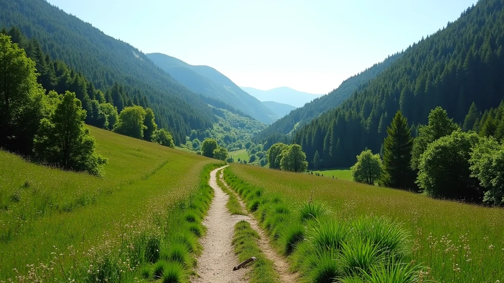
Walking through Pálava isn't just a physical activity — you're literally moving through layers of history. The limestone formations you see aren't just pretty. They've been quarried and used for centuries, and the landscape bears the marks of that human activity. What really sets Pálava apart is the archaeological significance. This region was settled by some of Central Europe's earliest agricultural societies, around 6000 BCE. The Neolithic sites here are considered important for understanding how human civilization moved north from the Mediterranean.
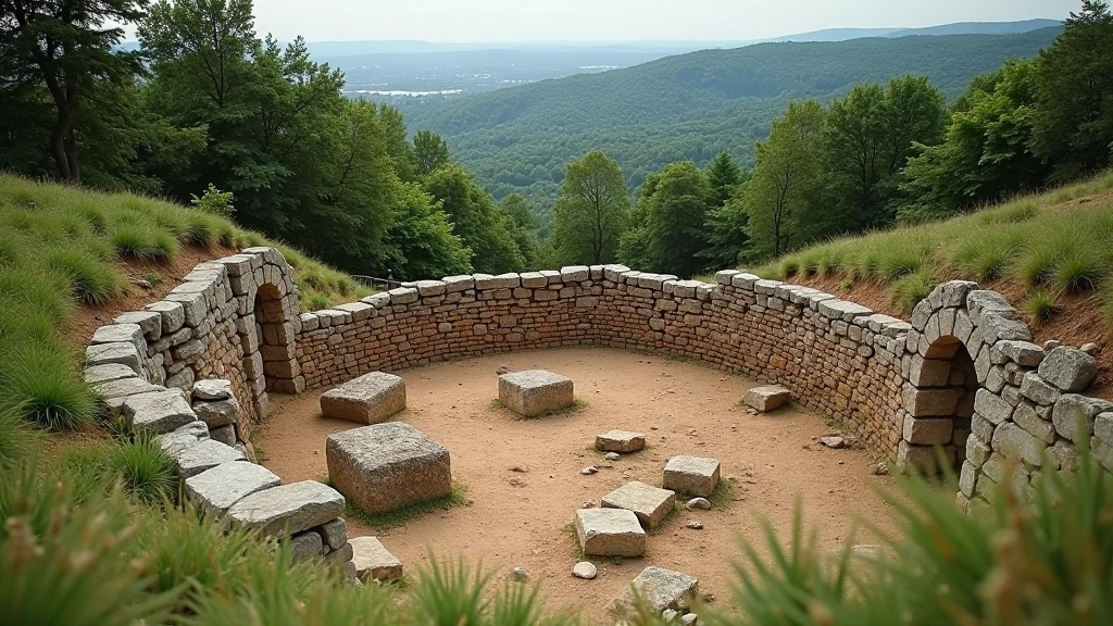
Near the village of Klentnice, you'll find remnants of fortified settlements from the Bronze Age and Iron Age. There's an actual archaeological museum in nearby Mikulov that contextualizes what you're seeing on the trails. You don't need to be a history buff to appreciate this — it just adds a dimension to the walk. You're not just exercising. You're moving through a place where people have lived, worked, and built communities for ten thousand years. That perspective changes how you experience the landscape.
Pálava is accessible from Brno by car in about 45 minutes. Public transport exists but involves connections — driving is more practical if you can. There are several parking areas near the trailheads. The village of Mělnická Vrutice is the most convenient starting point, with free parking and basic facilities nearby.
April through October is ideal. Spring brings wildflowers and comfortable temperatures. Summer can be hot, but the forest sections provide shade. Autumn has the best light and fewer crowds. Winter is possible but trails can get muddy and icy on steeper sections.
Bring at least 1.5 liters of water per person. There's a small restaurant in Mělnická Vrutice and a café near the Pálava visitor center. Don't count on finding water sources on the trails themselves — carry what you need from the start.
The limestone can be slippery when wet or worn smooth. Good trail shoes with real grip are essential. Don't attempt this in regular sneakers — the ankle support and sole quality make a real difference on the steeper sections.
The marked trails are reliable, but bring a map or download an offline trail app. Cell service is spotty in some areas. The official Pálava hiking map is available at the visitor center and covers all routes clearly.
Start early. Really. Parking fills up on weekends by mid-morning, and you'll want to finish before afternoon heat becomes an issue. The green and blue routes are best done in the morning when you're fresh and the light is good for photography. If you're doing the blue route, aim to reach the ridge by noon so you can enjoy the views without rushing back.
Plan a meal in one of the small villages afterward. This is wine country, and there are solid restaurants in Mikulov (15 minutes by car) that understand casual hikers — you won't need reservations or formal dress. The combination of a good walk and a proper meal afterward is the whole point. You're not just ticking a box. You're spending time in a place that's beautiful and has real character.
Don't feel obligated to do the full route if you're not feeling it. The trails have multiple exit points and connector paths. If you start the blue route and decide after the first climb that you want to do something easier, you can drop back to the green route without it being a failure. That flexibility is actually one of the best features of the Pálava system.
About 45 minutes into the blue route, you'll reach a limestone outcrop with views that justify the entire walk. On clear days, the visibility extends across three countries. This is where most people stop for a real rest and eat whatever snacks they brought. The rock formation provides natural seating, and there's enough shade from nearby trees.
Walking through areas where limestone was historically extracted is genuinely striking. The rock faces are dramatic, and you can see the layers that geologists use to date the formations. It's not dangerous — the quarries aren't active anymore — but it gives you a visceral sense of the landscape's actual geology rather than just looking at pretty hills.
From certain points on the higher trails, you can see Mikulov Castle across the valley. It's not on the trail itself, but it provides a historical anchor point. The castle is worth visiting separately — it's got a good museum and less demanding terrain for walking around the town.
The information in this guide is provided for educational purposes to help you understand the Pálava Hills trails and region. Trail conditions, difficulty levels, and accessibility can change based on weather, maintenance, and seasonal factors. Always assess your own fitness level honestly before attempting any route. Consult with a healthcare provider if you have concerns about physical exertion, especially if you have pre-existing health conditions. Bring appropriate safety equipment, tell someone where you're going, and don't hesitate to turn back if conditions become unsafe or if you're not feeling well. Weather can change rapidly — check forecasts before heading out and bring layers regardless of the season.